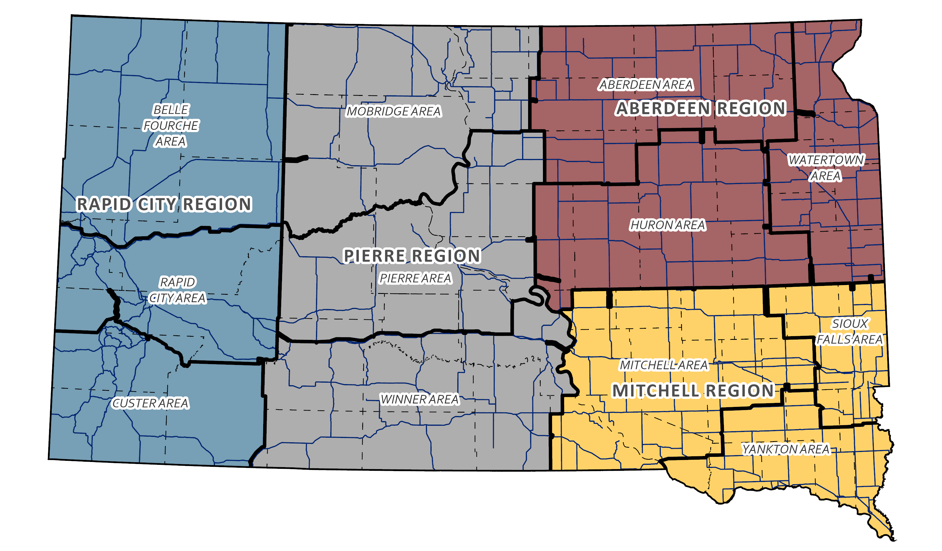
Airport Information

Airport Classifications
Commercial Service: These airports support some level of scheduled commercial airline service in addition to a full range of general aviation aircraft. This includes both domestic and international destinations. Airports in this category typically have a minimum runway length of 6,500 feet, with precision approaches, weather reporting equipment, major repair service, and Jet A/100 LL fuel available 24 hours.
Large General Aviation: These airports support all general aviation aircraft and accommodate corporate aviation activity, including business jets, helicopters, and other general aviation activity. These airports’ primary users are business related and service a large geographic region or they experience high levels of general aviation activity. Airports in this category typically have a minimum runway length of 5,000 feet, with non precision approaches, weather reporting equipment, minor repair service, and at least 100LL fuel available 24 hours.
Medium General Aviation: These airports support most twin and single engine aircraft and may accommodate occasional business jets. These airports support a regional transportation need. Airports in this category typically have a runway length of at least 4,200 feet, with non-precision or GPS approaches, weather reporting equipment, and on-call repair service.
Small General Aviation: These airports support primarily single-engine, general aviation aircraft, but are capable of accommodating smaller twin-engine general aviation aircraft. These airports support local air transportation needs and special use aviation activities. Airports in this category typically have a minimum runway length of 3,000 feet, with visual approaches.
Basic General Aviation: These airports support primarily single-engine, general aviation aircraft, special use aviation activities, and access to remote areas or provide emergency service access. Airports in this category typically have visual approaches.
Airport Directory
2023-2025 Directory Flight Planning
This directory is designed to help you, the flying public, operate safely at any South Dakota airport. Many of our airports are located near vacation and recreation areas. In just minutes from our airports you will find such opportunities as fishing on the Missouri River or on one of many glacial lakes, pheasant hunting in rolling hills, hiking and scenic beauty in the Black Hills of South Dakota. Whether you are flying into one of our airports for business or pleasure, we hope you will have a safe and enjoyable journey.The Airport Directory was prepared using the best information available to the Department of Transportation. The State of South Dakota does not assume responsibility for inaccurate or incomplete information contained herein due to problems in reporting and ever-changing airport conditions and service facilities. Please refer to the FAA's Airman's Information Manual and contact the nearest Flight Service Station to determine current conditions at unfamiliar airports.
AIRPORT Zoning Information
